
Entangle! A Designer's Quest to Reconnect New Yorkers with Urban Wetlands
In an era of funding cuts, growing data gaps, and political rhetoric dragging swamps through the mud, wetlands are in dire need of advocates. Monty Preston's thesis, Entangle! Reconnecting to Wetlands Through Citizen Science, explores how structured encounters can change how we spend time with wetlands in New York parks, creating stewards who both care about them and contribute to their conservation.
"Transformation is not accomplished by tentative wading at the edge."
- Robin Wall Kimmerer, Braiding Sweetgrass
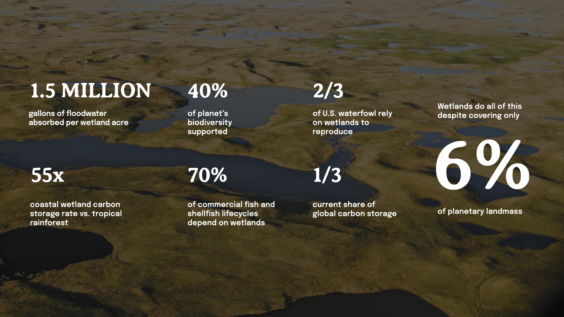
Wetlands are historically maligned ecosystems, but they're crucial resilience infrastructure against rising seas and extreme rainfall. They filter pollutants, store carbon at rates 55 times faster than tropical rainforests, and act as natural sponges that absorb water and slow tides, all while covering just 6 percent of the planet.
Urban planners around the world are recognizing the value of wetlands, creating Sponge Cities that use wetlands as infrastructure to capture and slow unmanageable waters. But in the US, legal protections for wetlands are being rolled back and federal funding is being cut — creating data gaps that undermine conservationists' work.
Connection to urban nature happens through encounter, not information. Citizen science provides a model for encounters that benefit both citizen and ecosystem, creating relationships that make wetland stewardship possible at scale.
The Problem Under Our Feet
New York City has lost 99 percent of its wetlands since colonization. Today, 30 percent of residents live in flood zones, and up to 4.4 million New Yorkers face risk in the case of extreme flooding.
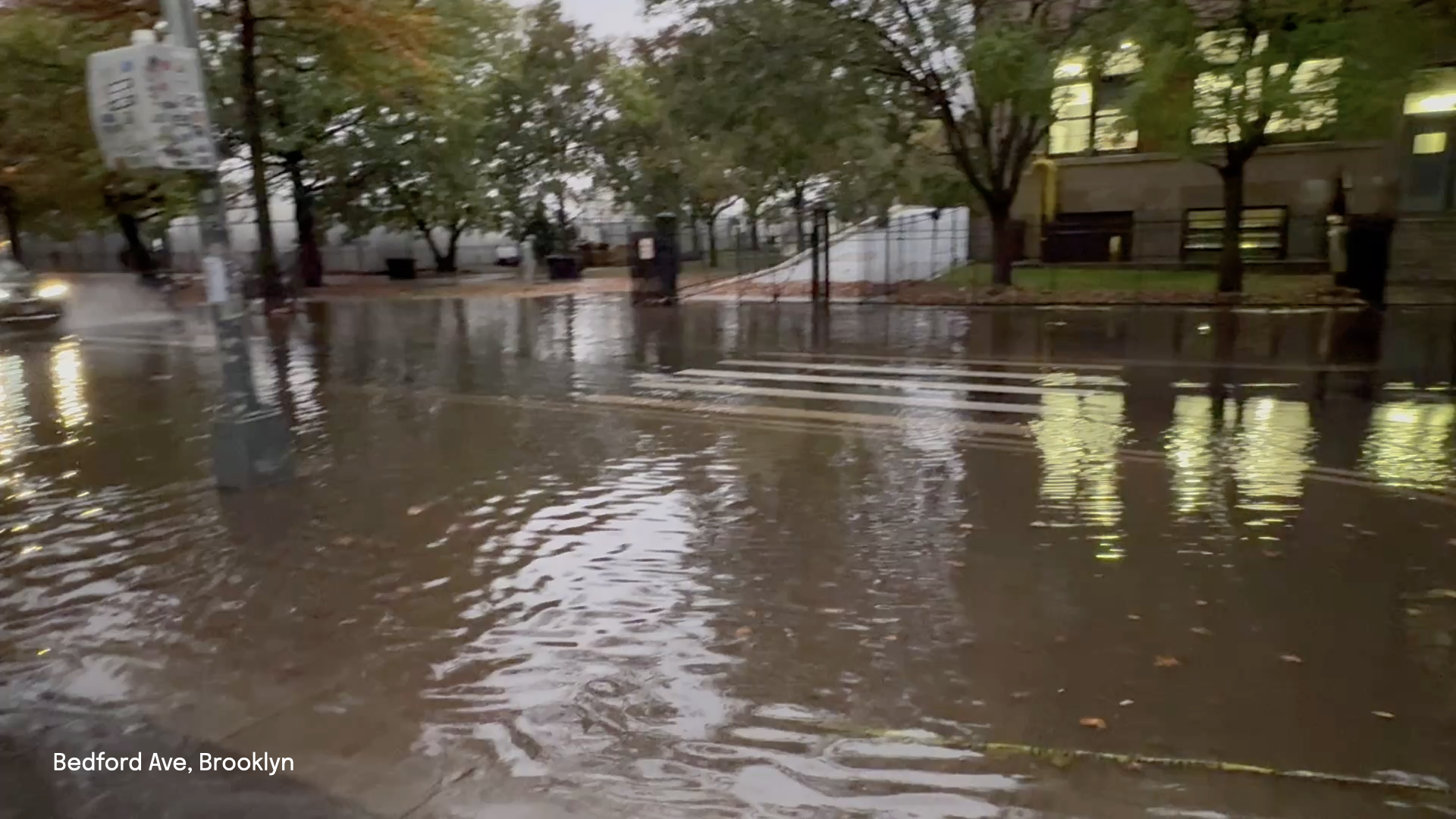
Manhattan was once Mannahatta, the traditional homeland of the Lenape people, and a thriving expanse of forests, swamps, and tidal marshes. When European settlers arrived, they saw wetlands as unproductive obstacles and filled them in. Now the overdevelopment of coastal land makes flooding more likely, not less.
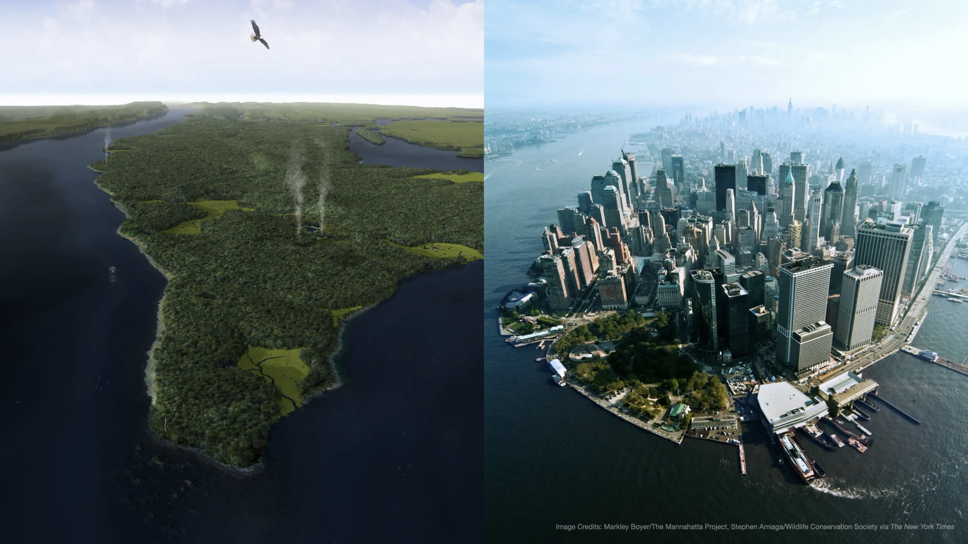
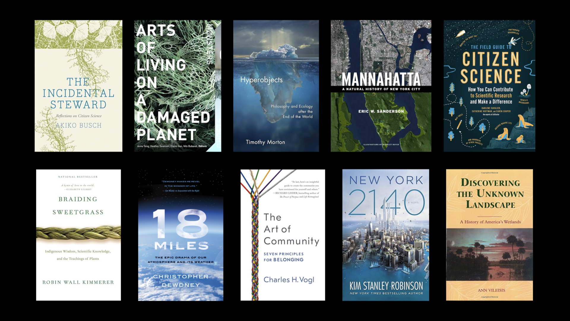
To make matters worse, wetlands carry a lot of negative cultural baggage. The words we reach for to describe difficulty and disgust — bogged down, swamped, in the weeds — are almost all wetland words, and over 60 percent of their depictions in film and media are predominantly negative. As historical ecologist Anne Vileisis writes in Discovering the Unknown Landscape: A History of America’s Wetlands, changing perspectives on these ecosystems is not a matter of science alone but one of culture. At a moment when federal funding for wetland conservation is being cut and legal protections are being reversed, Monty wanted to understand why wetlands had become so easy to sacrifice, and whether design could help reset that relationship.
Finding the Answer in the Field
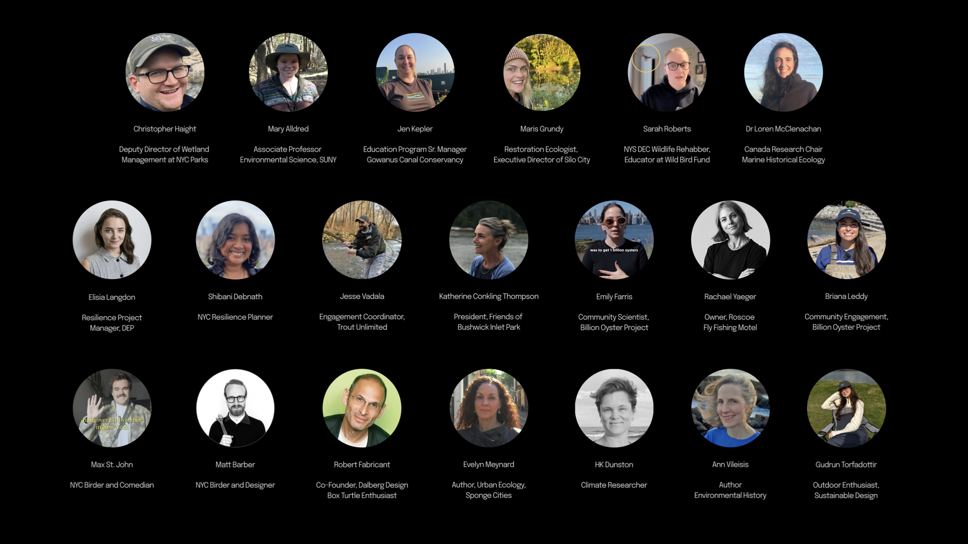
Monty spent a year reading across ecology, eco-philosophy, Indigenous tradition, and science fiction. She took a course on resilient waterfront design through the Waterfront Alliance and interviewed a dozen experts across ecology, wildlife education, community organizing, and outdoor recreation.
The answer was consistent. Transformation happens in the field, through embodied experience. "Hands in mud," said Jesse Vadala, an Engagement Coordinator in waterway conservation.
This is complicated because humans can be damaging to fragile environments. But Monty felt uniquely positioned to take on this challenge. Not only is she a designer, she's a citizen scientist. You might find her wading out of the East River with oyster cages, counting trees for the NYC Tree Census, or lined up at a community hearing to advocate for wetland conservation. She wanted to understand whether citizen science could create the conditions for that same kind of transformation at scale for wetlands.
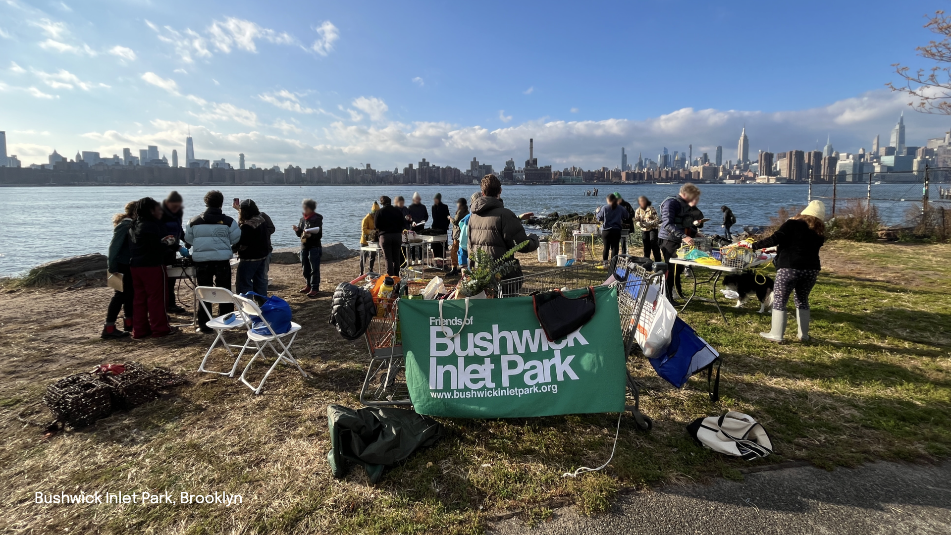
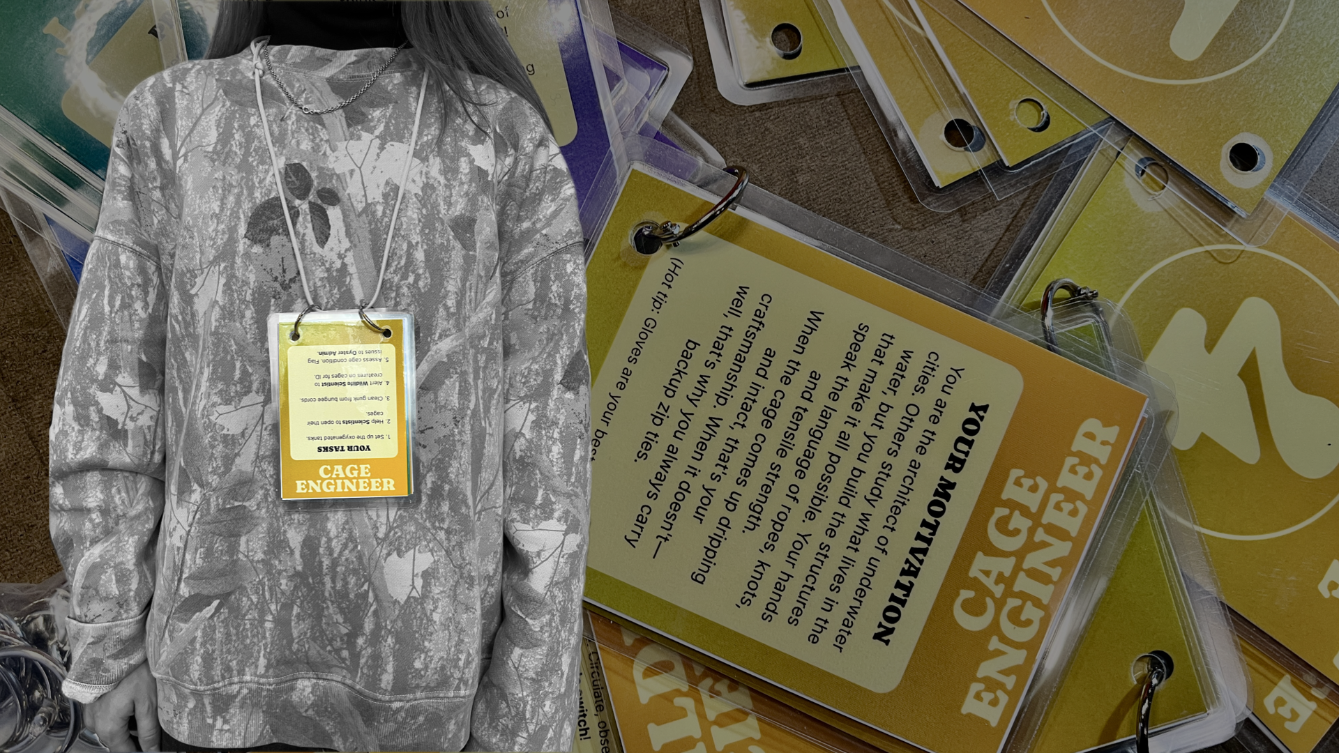
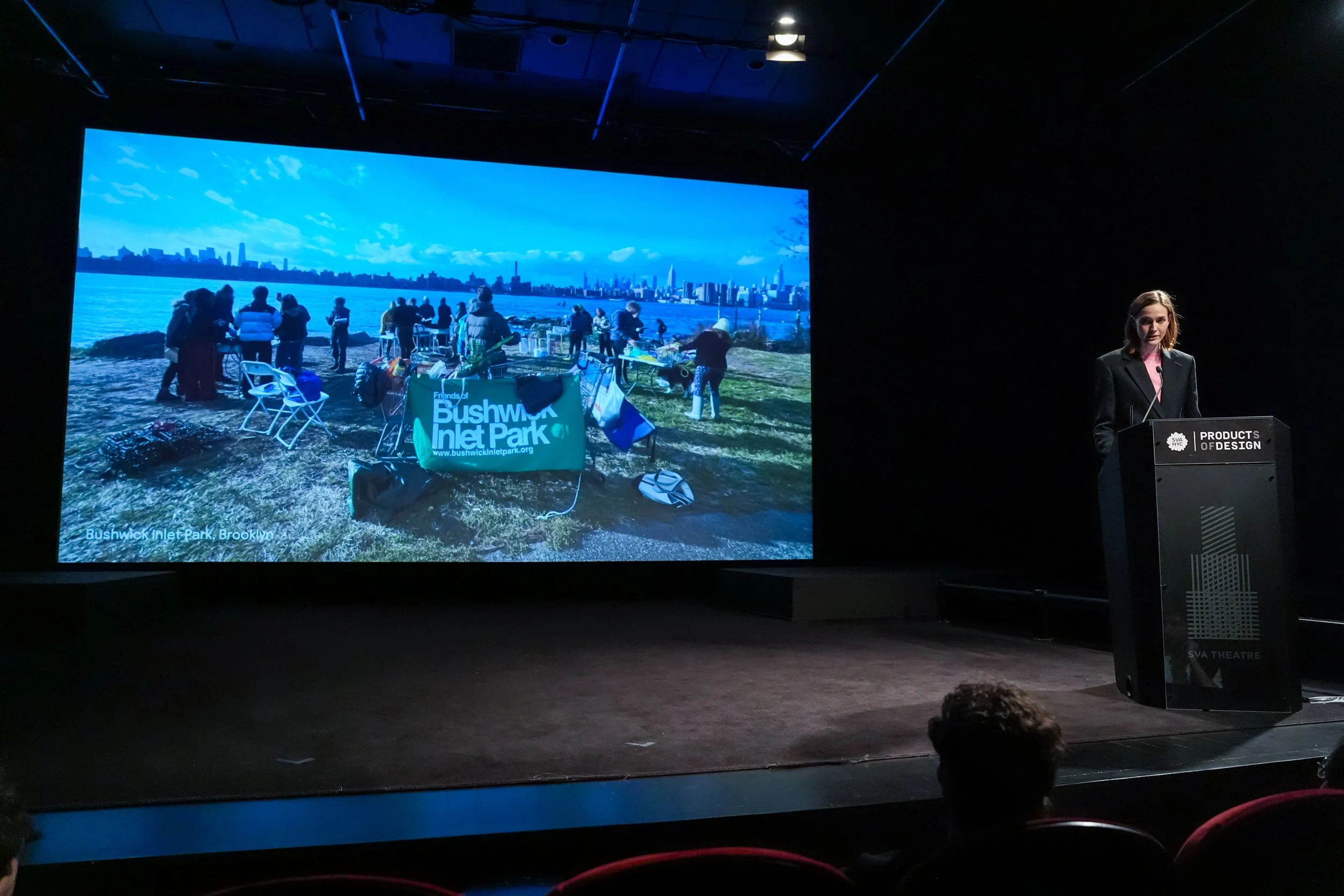
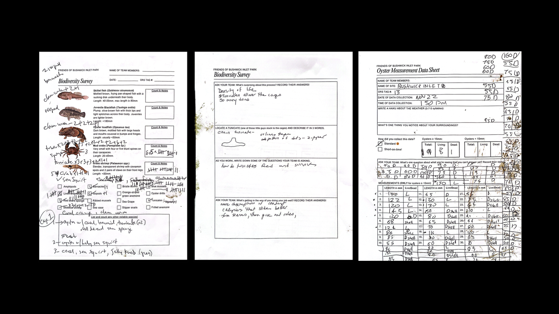
To test this in practice, Monty held two citizen science experiences. The first was an oyster monitoring workshop with the Friends of Bushwick Inlet Park, where she designed wearable role cards and experimental data sheets that gave participants a structure for moving through the monitoring process in real time. The second was Get Naturalized, a scavenger hunt-style naturalization event where she intercepted passersby at Bushwick Inlet Park with citizenship passports, sensory guides, and site-specific bingo cards.
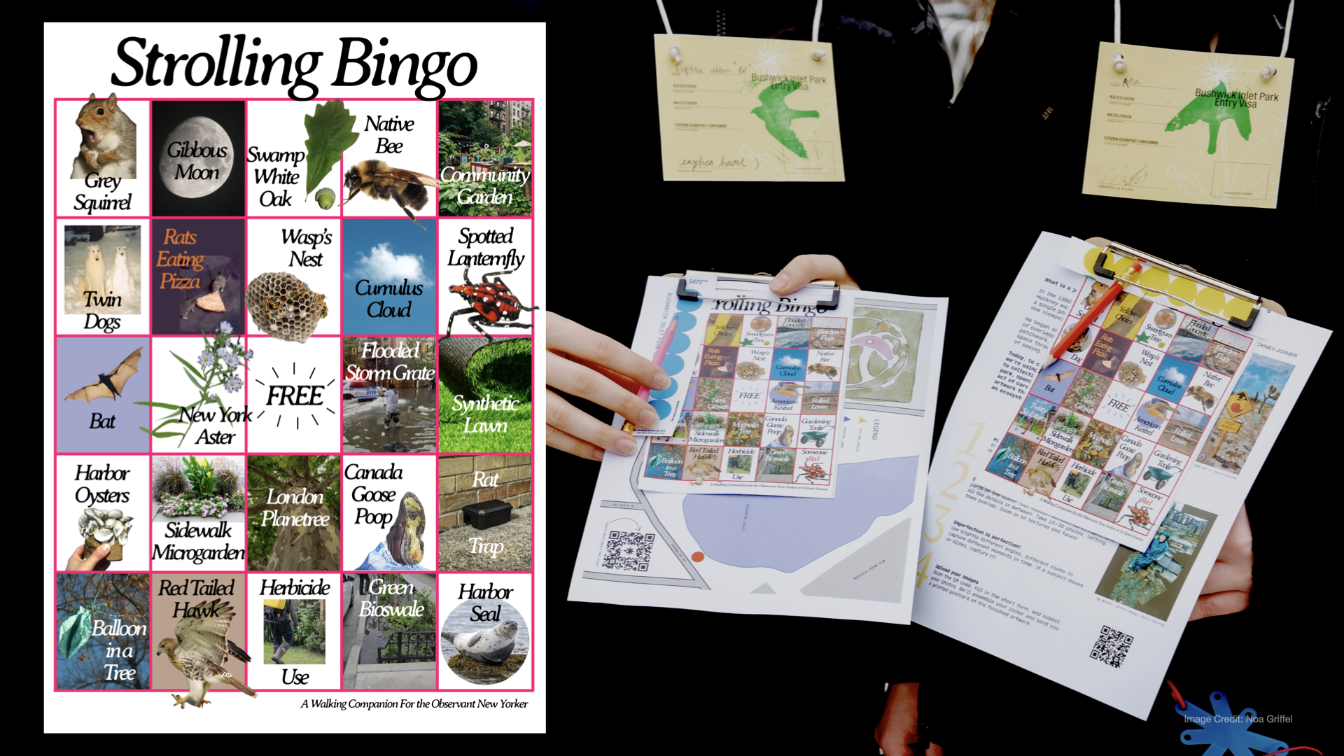
Monty found that challenges and quests build community stories, and that biodiversity identification has a snowball effect that builds motivation to keep learning. But the failures were equally instructive. Data was inconsistent and its reach was limited. Scale and consistency were wide-open questions. From that gap, three designed products emerged.
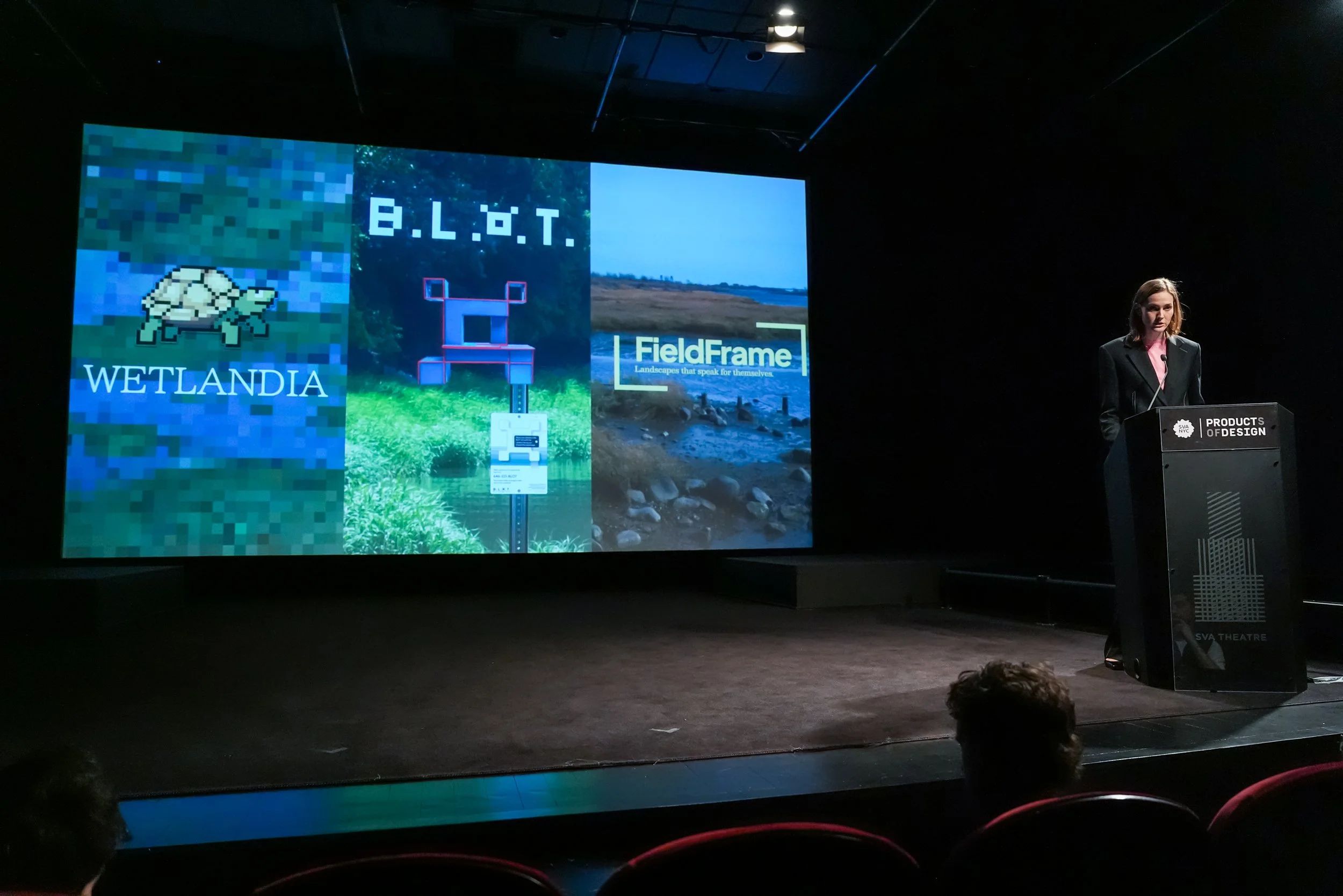
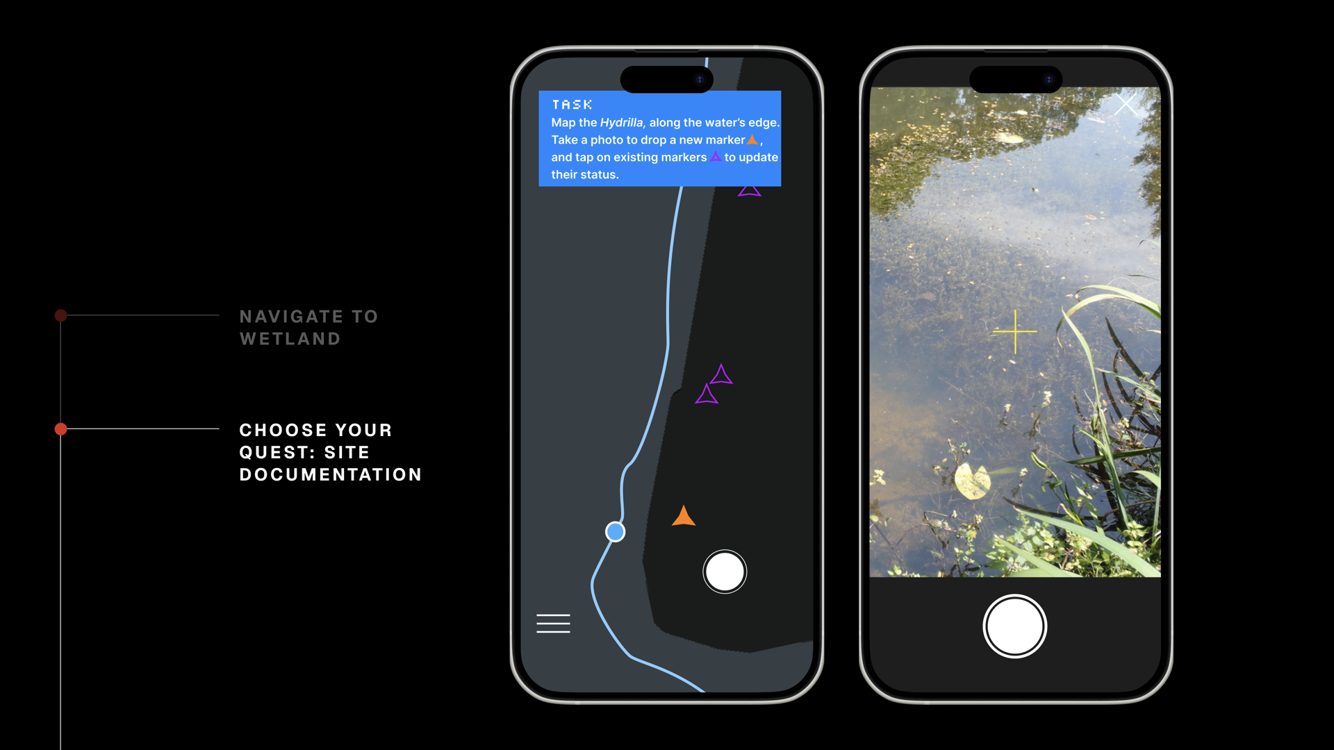
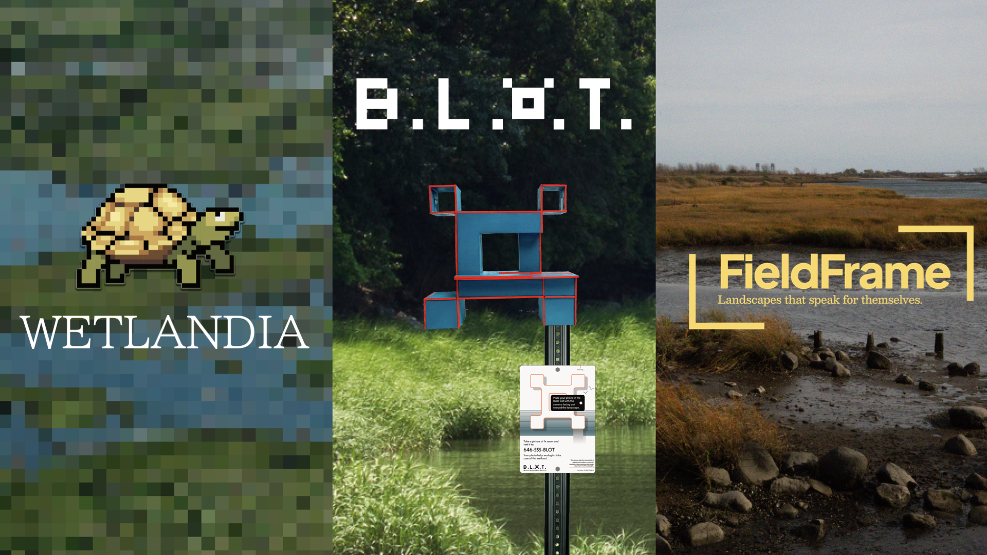
Wetlandia
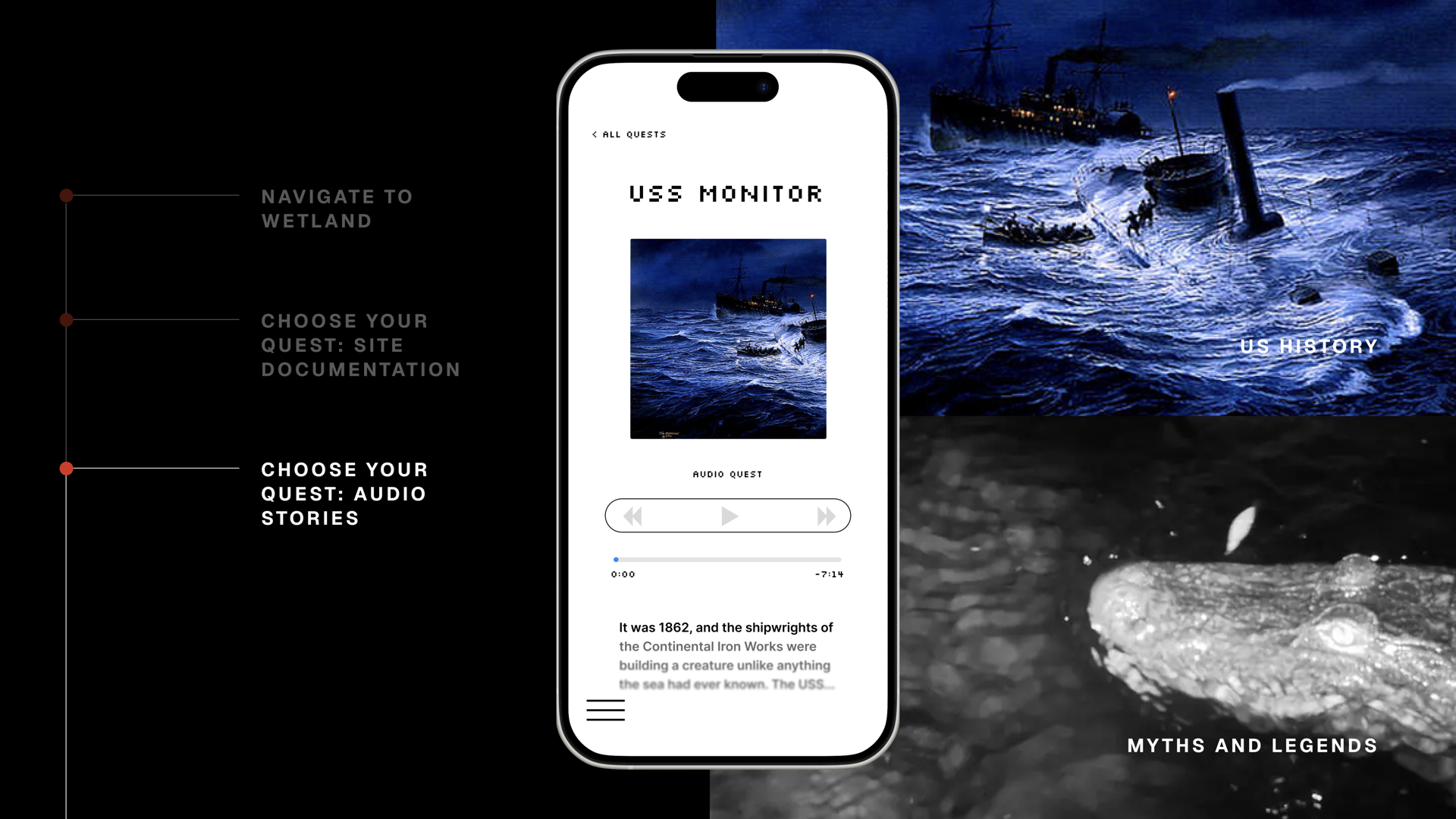
Wetlandia is a quest-led, wetland exploration game for New Yorkers. For the first time, all of New York City's urban wetlands are mapped together interactively in one place. Players navigate to a real wetland, complete ecology-informed challenges (such as mapping invasive species, photographing seasonal change, identifying biodiversity), and earn points and badges through data submission.
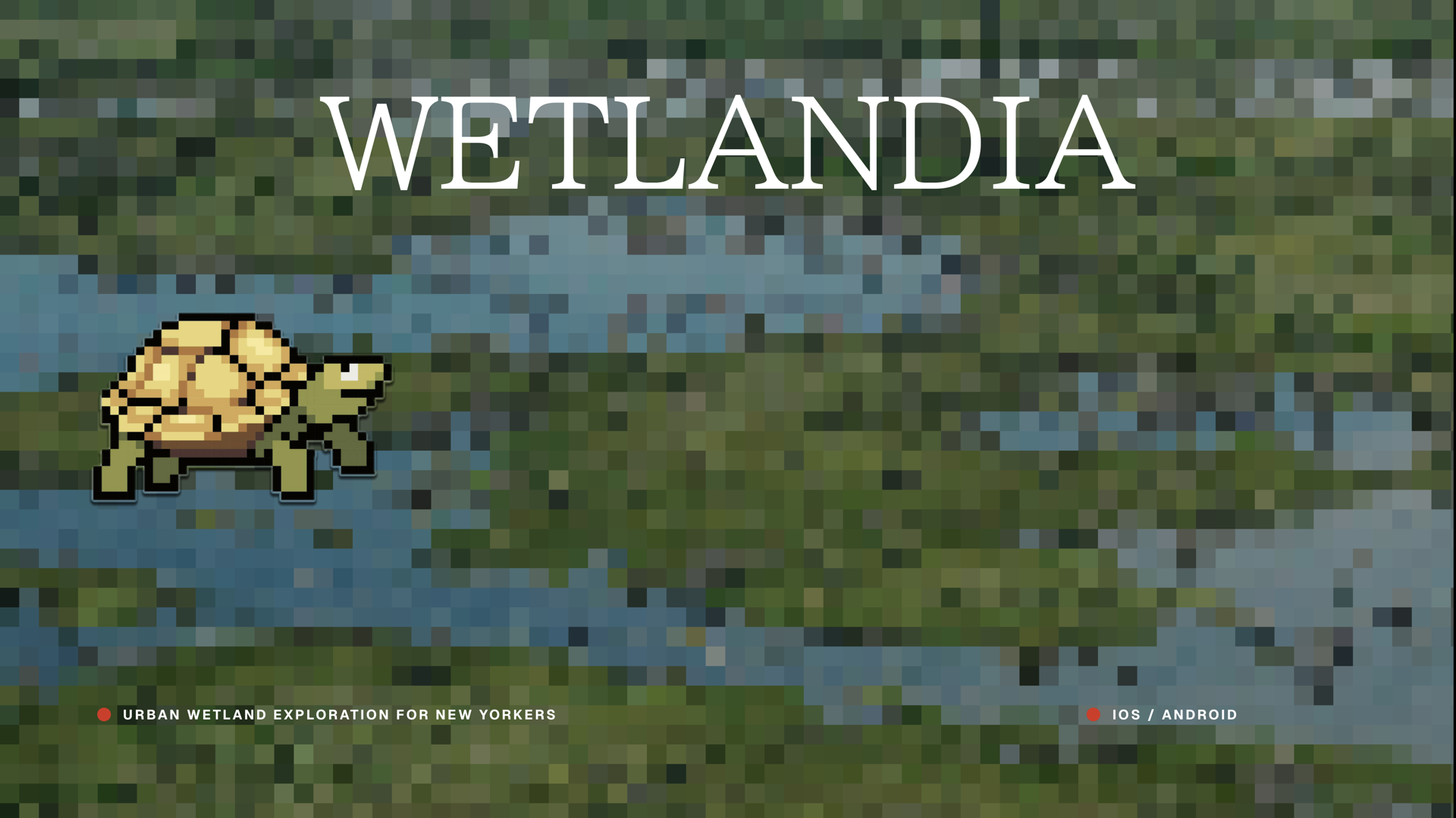
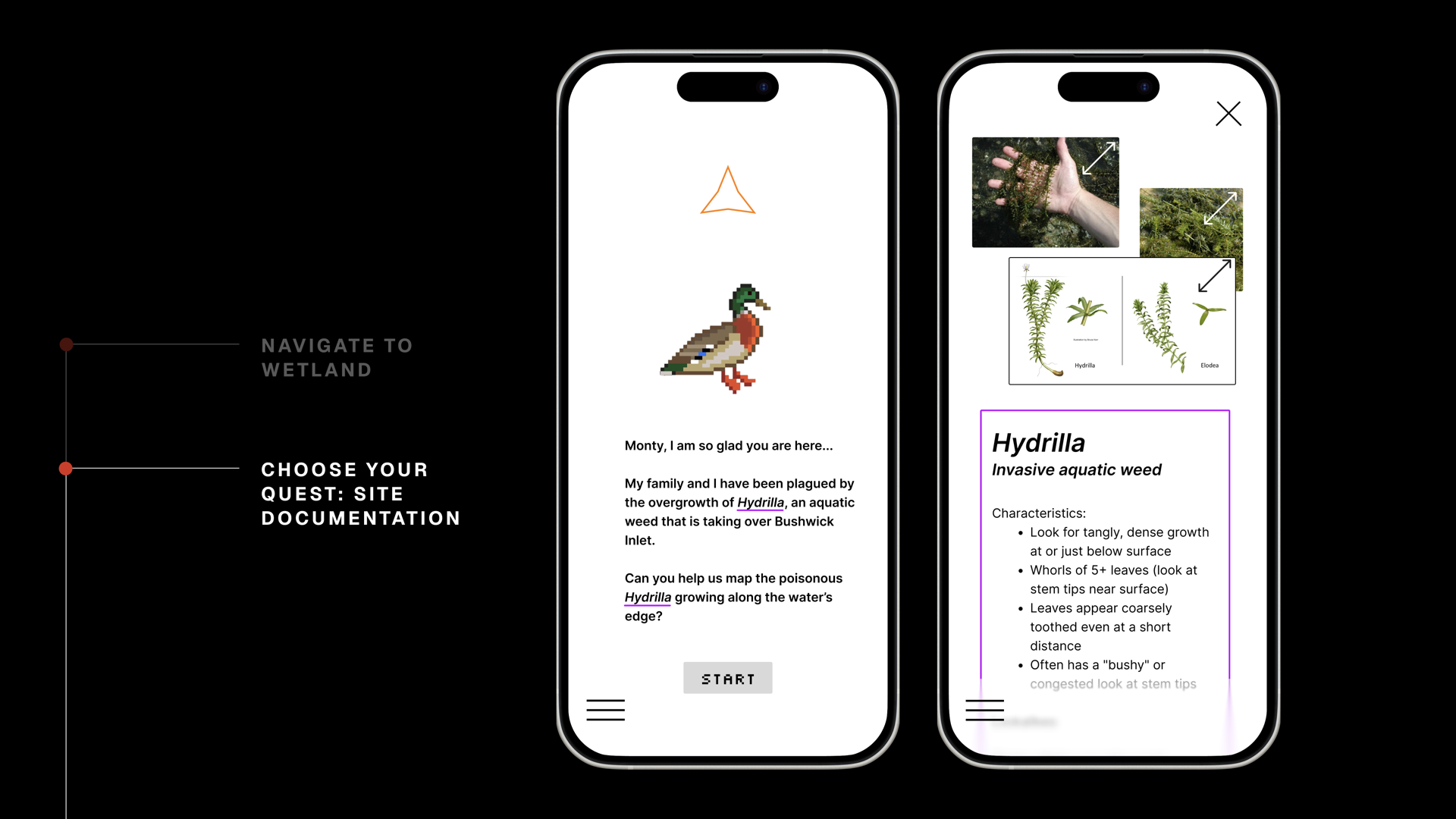
Audio quests layer in place-based histories drawn from the research of Eric Sanderson and the Welikia team, who have mapped New York's ecological transformation from colonization to the present. Players hear the stories of the land and learn the value of New York's wetlands. New map areas unlock as restoration projects open to the public, so the game grows with the city.
Collected data is submitted to open source data bases, meaning each completed challenge feeds into a growing ecological dataset.
BLOT
Wetlandia could bring people to a site, but Monty wanted to ensure that collected data was useful and consistent.
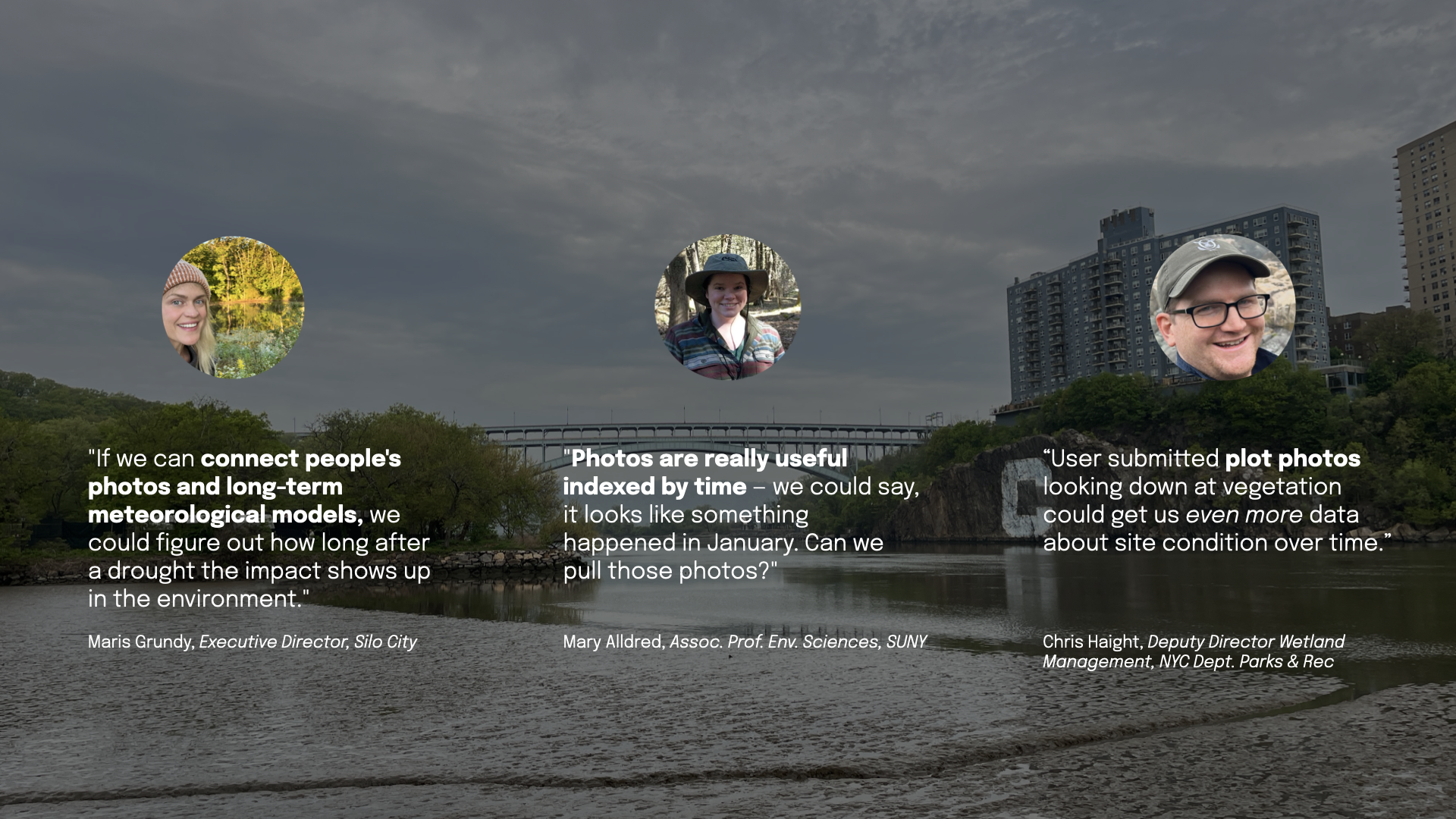
Chris Haight, Deputy Director of Wetland Management at NYC Parks, gave Monty a clear problem. Restoration projects lose visibility as they get older, creating data gaps for conservationists. What Chris' team needed was a consistent photographic record of every site across the city.
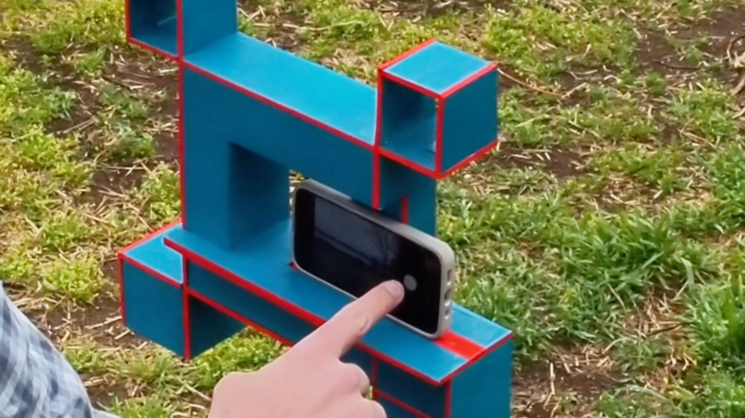
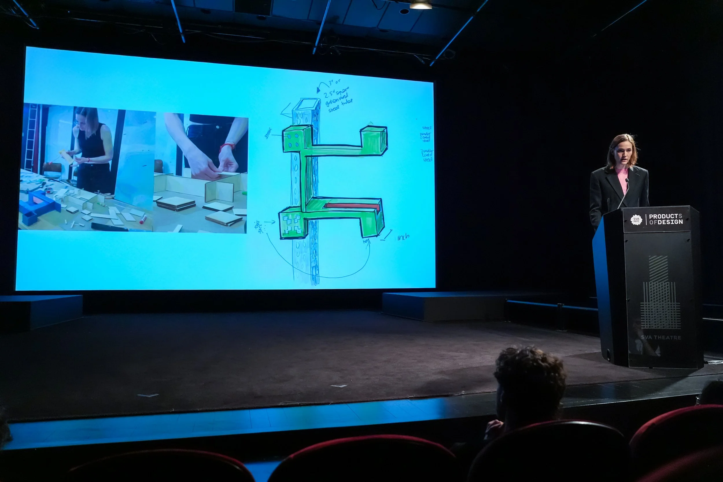
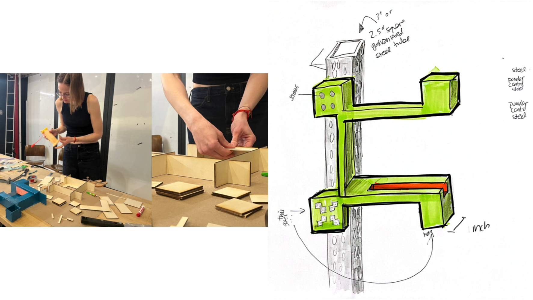
BLOT (the Biodata Ledger Open Terminal) is a physical registration station installed at wetland lookout points across the city. Visitors slide their phone into a slot that locks the camera to a standardized angle, take a photo, and text it to a number. No app required!
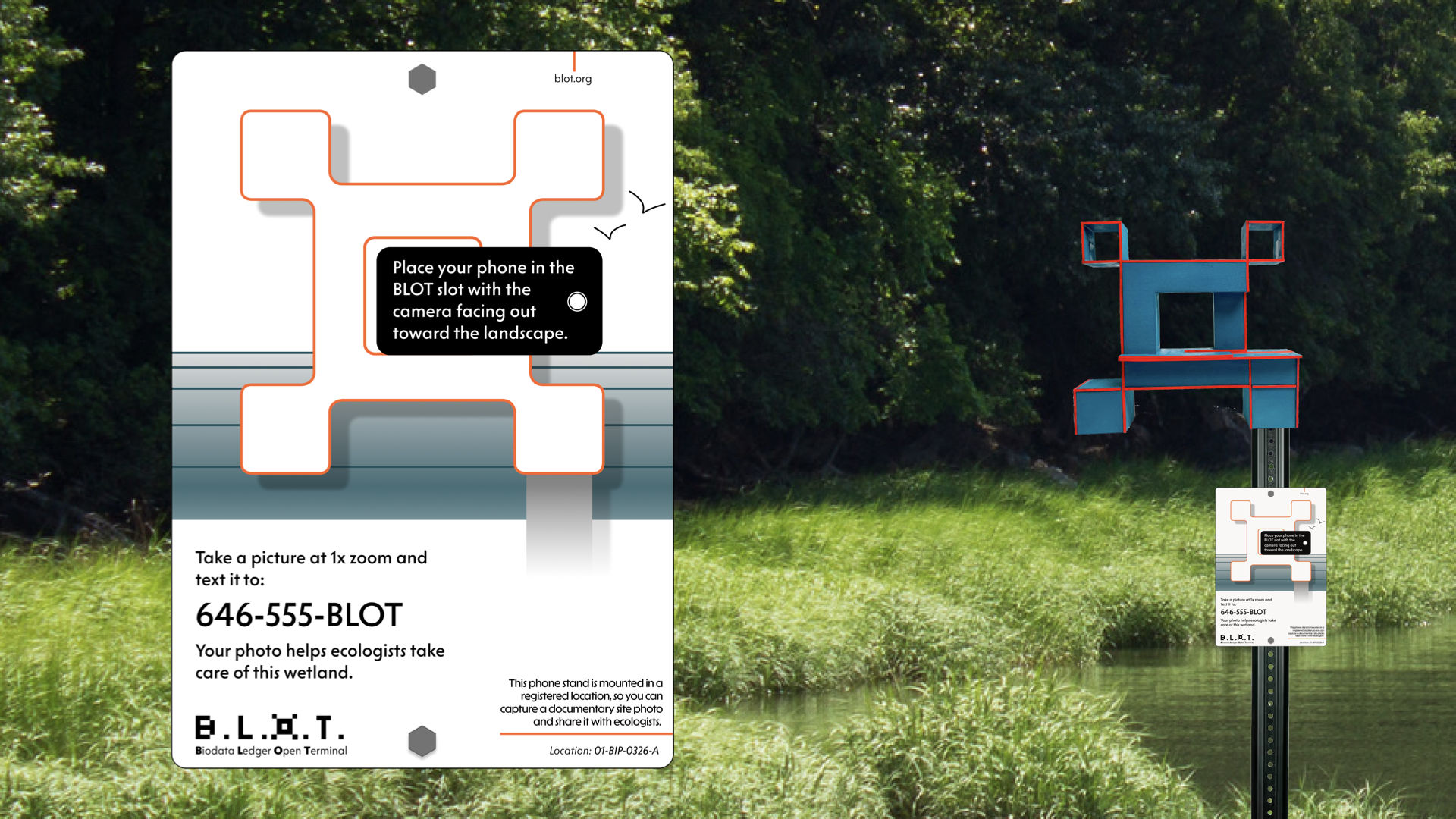
The BLOT Bot responds, personifying the ecosystem. After a deliberate delay designed to keep visitors present rather than on their screens, it sends a link to a time lapse viewer featuring highlights from the site's photographic history, including wildlife sightings, storm scenes, tidal patterns, and first blooms. Over time, contributors build a personal map of every wetland they've ever documented, reinforcing a sense of contribution and connection to visited places.
BLOT is designed for durability and simplicity. The final product is powder-coated steel, rugged and low-maintenance, installable with equipment already carried by NYC Parks teams. It stands out in its environment like a flag on a post to catch the eye of passersby.
Field Frame
Now there was a living visual record being built by the public. But Monty kept thinking about the scientists on the other end. How does a massive influx of images not become a burden for an already strapped team?
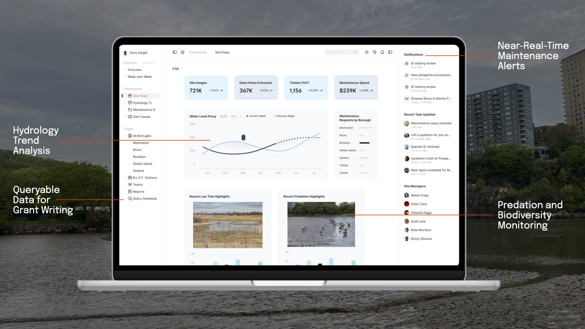
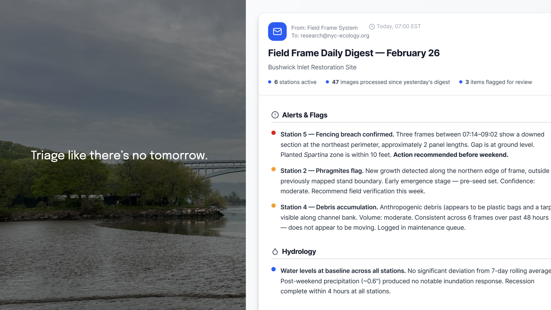
Field Frame is a computer vision analysis service that turns community-submitted wetland photos into actionable ecological data for scientists. AI agents extract hydrology information, flag invasive species, document seasonal change, and surface behavioral observations from wildlife sightings. Scientists receive weekly email digests and near-real-time alerts for urgent events like flooding or predation.
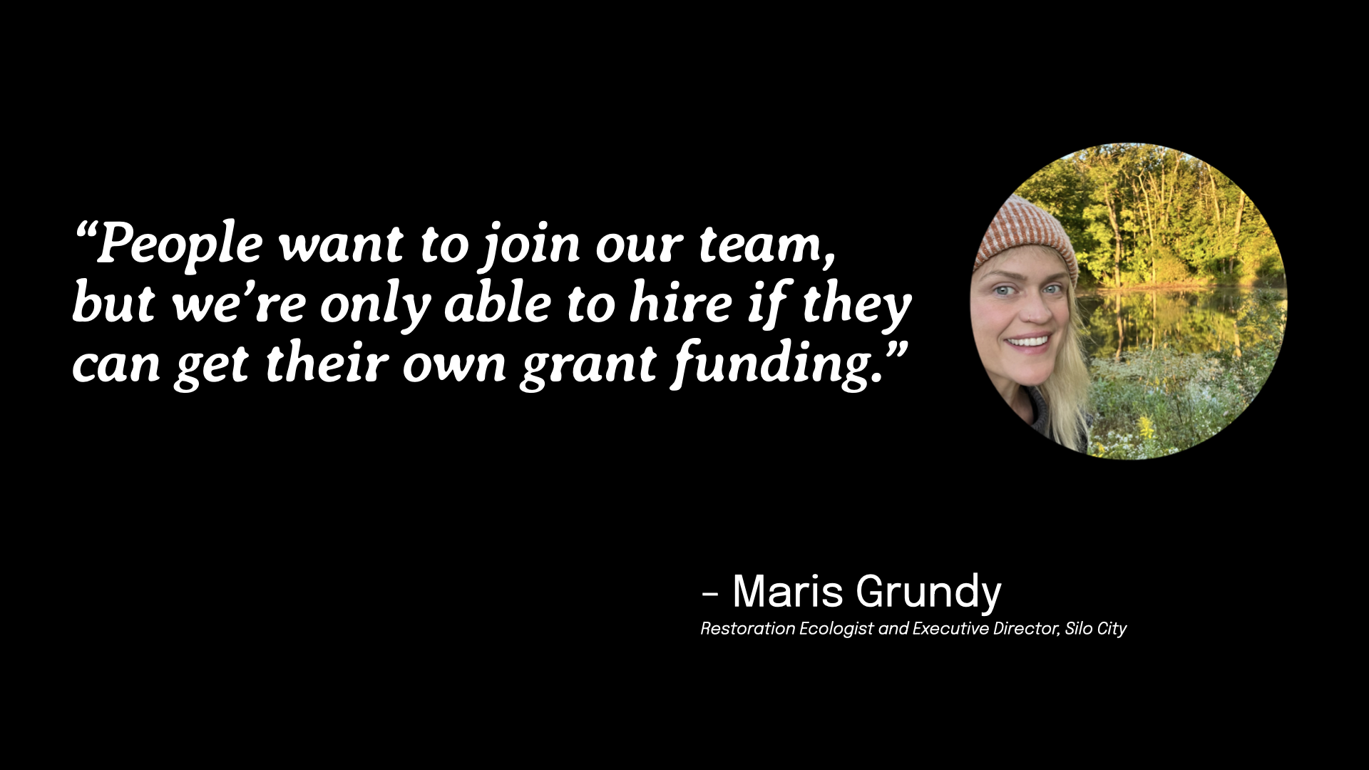
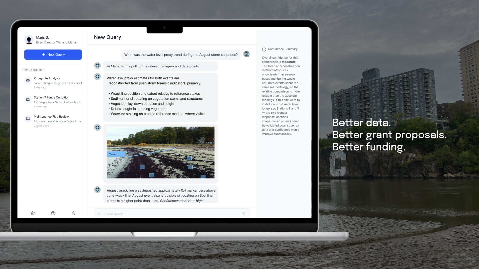
All data is queryable through a plain-language chatbot. Ecologists can ask questions in ordinary language and receive structured responses in seconds. That matters more than it might seem. Maris Grundy, a restoration ecologist and the Executive Director of Silo City, told Monty that applying for grant funding was a major blocker for growing her team. Field Frame's queryable dataset directly supports that process, letting ecologists pull figures, generate longitudinal summaries, and build funding cases with data that would have previously taken days to assemble.
The response from ecologists was positive, who suggested additional use cases and ways to integrate Field Frame into existing forecasting, modeling, and investigative analysis.
An Ecosystem for Ecosystems
These three products work together as an ecosystem of their own. Wetlandia creates the first encounter, meeting New Yorkers where they are and physically moving them to wetland sites they may never have noticed. BLOT standardizes what happens when they arrive, converting a casual visit into a data point. Field Frame closes the loop, turning community-generated data into something wetland scientists can act on and advocate with. This is what care looks like at scale: a city of witnesses generating data that protects the ecosystems that protect our city.
“There is a Swampy Cree proverb suggesting we may see where we are going by watching where we have been,” Monty shares. “The data collected today is the record the next generation of stewards will look back to. How we pass that knowledge down ensures that what we care for now, they can care for too.”
For more of Monty’s work, visit www.montypreston.xyz.